Sponsored
Satellite Data in Construction: A New Era for Infrastructure in the UK
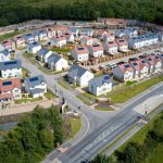
Across the United Kingdom, construction projects shape the landscape of cities, towns, and rural areas alike. Whether it is a new transport hub in London or housing development in the Midlands, these efforts involve complex decisions, tight deadlines, and constant risk management. To meet growing demands for speed, sustainability, and precision, many developers are now embracing tools that offer more than what can be seen from the ground. One of the most valuable tools rising to the surface is satellite data.
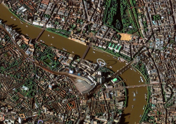
Among the most frequently used sources of Earth observation is MODIS satellite imagery which captures wide-scale environmental conditions and land use patterns. This type of imagery is proving essential for construction companies seeking greater visibility into the terrain, climate conditions, and long-term trends that influence a site’s potential.
Satellite Data in the UK
In recent years, satellite data has become more accessible and useful for industries across the UK. It is widely used in agriculture, forestry, energy, and climate analysis. Construction is now becoming one of the latest sectors to benefit from this perspective.
By using satellite images, project managers and planners can observe sites before visiting them. They can also review historical data, check environmental constraints, and track land use across large regions. This approach saves time and allows for more informed decision-making, especially during the planning and permitting stages of a project.
In 2024, the Geospatial Sector Market Report revealed that the UK’s geospatial industry, including satellite data, is now worth over £6 billion, supports around 38,000 jobs, and has attracted more than £1 billion in investment since 2013. The report highlights how this data is increasingly vital to sectors like construction, where understanding terrain, environmental impact, and land-use changes can reduce delays and improve planning. For construction teams, these insights make satellite imagery a powerful tool for everyday decisions, from site selection to ongoing monitoring, helping projects run more efficiently and responsibly.
Construction and Satellite Data
Every construction project begins with a single question: where should we build? Satellite data helps answer this with accuracy and efficiency. Using tools that display up-to-date Earth imagery, developers can evaluate terrain, soil conditions, vegetation cover, and proximity to existing infrastructure. With access to MODIS imagery, they can also consider long-term environmental patterns such as seasonal flooding or vegetation changes.
Once a site is selected, monitoring becomes a daily concern. Satellite images provide a clear and timely view of progress, weather impacts, or any unexpected changes in surrounding areas. They offer neutral, visual evidence of how a site is evolving, which can be especially helpful when dealing with delays, inspections, or third-party reports.
Environmental responsibility is also a growing priority in the construction sector. With data from MODIS satellite data, teams can detect whether nearby vegetation is being affected by construction or if runoff is impacting surrounding waterways. This kind of monitoring supports companies in staying compliant with local regulations and in meeting their own sustainability goals.
Risk management is another critical benefit. Flood-prone zones, unstable slopes, or erosion risks can all be evaluated through satellite pictures. Being able to see these patterns clearly from above helps engineers and architects design buildings and infrastructure that are safer and more durable over time.
EOSDA LandViewer and MODIS
To make the most of satellite data, users need a platform that simplifies access and analysis. EOSDA LandViewer offers a way to search, visualize, and analyze satellite imagery without needing specialized technical training.
The tool gives users access to multiple satellite sources, including MODIS images, which are especially helpful for observing environmental change over time. The platform allows users to create time series analyses, detect changes in land cover, and generate 3D visualizations of terrain.
These tools help construction professionals understand how land has shifted or changed, how it might behave in the future, and what kind of development is most suitable. By combining recent and historical data, teams gain a clearer picture of the full landscape surrounding their project.
The interface is simple enough to use without deep geospatial knowledge, which makes it a realistic choice for construction firms that want results without having to build a full-time analytics team.
The Future of Construction in the UK
Construction in the UK is expected to grow steadily over the next decade, particularly in areas like transport, housing, and clean energy infrastructure. At the same time, the industry is under increasing pressure to cut emissions, reduce delays, and improve long-term resilience.
This creates a perfect moment for satellite data to step in. Tools like MODIS image analysis offer a broader and deeper view of the land, helping firms stay ahead of potential problems while planning smarter, more sustainable projects.
As climate change continues to reshape environmental conditions across the UK, satellite data will become even more valuable. Whether it is responding to flooding in low-lying areas or identifying safe zones for new developments, the ability to see the land from above brings clarity that is hard to achieve from the ground alone.
With platforms like EOSDA LandViewer, the process of using satellite imagery is no longer complicated or limited to researchers. It is becoming a practical, everyday tool for people making big decisions about where and how we build.
Satellite data is changing the way the UK builds. From understanding terrain to tracking environmental impact, it brings knowledge that supports better planning, better safety, and better results. And at the heart of this new perspective, tools like MODIS satellite imagery are helping the construction industry move forward with confidence.
Author: Kateryna Sergieieva
Kateryna Sergieieva has a Ph.D. in information technologies and 15 years of experience in remote sensing. She is a scientist responsible for developing technologies for satellite monitoring and surface feature change detection. Kateryna is an author of over 60 scientific publications.