News - Construction News
Transforming data sharing, modelling and visualisation of infrastructure

Guest article from Samuel Chorlton, DAFNI Project Lead, Science and Technology Facilities Council (STFC), UK Research and Innovation (UKRI)
To date there have been myriad challenges around large infrastructure and construction projects, whether in areas such as roads and rail, water and sewerage, power supplies, or new towns. It has been extremely challenging in part because there has not been a way to map and model all the different infrastructures at once and particularly their interdependencies.
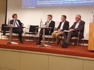
Panel discussion: left Professor Jim Hall, centre Mark Enzer, Chair of the DFTG and Chief Technical Officer, Mott McDonald, middle Chris Jones, Research & Development Manager, Northumbrian Water Group; right Dan Rennison, Head of Data Insight, Costain Ltd
This is now changing with the advent of a new infrastructure planning tool namely the Data and Analytics Facility for National Infrastructure (DAFNI), which is being delivered by the Scientific Computing Department based at the Science and Technology Facilities Council located at Harwell Campus outside Oxford.
DAFNI 1.0 is designed to allow a more cohesive picture of the UK’s infrastructure needs, possibilities and policies to be developed. Currently in alpha phase, the platform is open to academic and industry partners who wish to collaborate with the DAFNI team of expert modellers and programmers to finalise developments ahead of it being open more widely from 2021.
The level of detail available through the datasets allows planners access to previously inaccessible mapping of fine details such as individual roads, broadband locations per household, individual houses, water and sewerage systems. Not only that but it can also draw on rigorous predictions in the models and consistent methodology, to identify trends such as likely population growth and make up of that population to individual household level, or how the location of a new train station would impact on existing train and other transport users and networks.
This will help to ensure that spending on new infrastructure and utilities is more targeted and more sustainable, that local authorities can collaborate across unitary borders, that businesses are more productive, communities safer and healthier, and that large infrastructure projects can be better costed and planned in a smarter and more joined up way.
The DAFNI team are already working with groups across industry, government and academia, including Ordnance survey, the Department for Transport, Northumbrian Water, Mott MacDonald, Costain, University of Oxford, Oxfordshire County Council, Infrastructure Transitions Research Consortium (ITRC), and the National Infrastructure Commission.
When Chancellor Philip Hammond commissioned a study in 2018 on infrastructure resilience to identify how resilient the UK’s infrastructure is now and what needs to change to improve resilience and minimise cascade failures[1], he noted that: “The development of the Data and Analytics Facility for National Infrastructure (DAFNI) provides a particular opportunity to undertake an in-depth analysis of resilience, working with key stakeholders.”
As Sir John Armitt, chair of the National Infrastructure Commission, stressed at the DAFNI Conference in June 2019: “Data is now as important to UK infrastructure as concrete or steel. The key is not just the quality of the data we collect, but how we process it and finally how and where we use it. That’s why the [June] launch of the UK’s Data and Analytics Facility for National Infrastructure is an important step forward in using data to transform how we think about infrastructure.
“DAFNI provides a strong platform to help us to do this [ask the right questions about resilience]. It gives us the opportunity to ensure that the recommendations we make in the next Assessment will be based on the best data and robust modelling.”
DAFNI consists of five key parts:
- National Infrastructure Database (NID) This is a library of datasets. Metadata tags are incorporated to make searching the database easier.
- National Infrastructure Modelling Service (NIMS) This is split into two main parts – the national modelling catalogue, and the workflow section where you can drag and drop elements of different models to create new ones. The aim is to allow non-specialists to tap into the models whilst allowing modellers to set permissions on who can use their work.
- National Infrastructure Cloud Environment (NICE) Users can make use of the high processing computing power behind DAFNI 1.0 to develop and increase the speed of their models, which may involve hundreds of gigabytes and provides greater scalability. DAFNI 1.0 uses best practices in industry, such as hybrid cloud and onsite investment.
- National Infrastructure Visualisation Suite (NIVS) Modellers can create 3D renders and 2D plots to tell effective and meaningful stories through visualisations.
If you are a policymaker, in local or central government, a consultant, contractor, planner or researcher, do get in touch to find out more about DAFNI 1.0 and how it is set to transform research, planning and policymaking around infrastructure in the UK and beyond and how you could access and help shape the platform.
Watch highlights from the confernce launch:
Reference: [1] Letter from Philip Hammond, Chancellor of the Exchequer, HM Treasury, to Sir John Armitt, Chair of the National Infrastructure Commission. Dated 29 October 2018.


More News
- FM Conway Secures £1.25 Billion Westminster Highways and Public Realm Contract
10 Jul 26
FM Conway wins Westminster highway asset management contracts.
- UK SMR programme at Wylfa hitting target for British contracts
9 Jul 26
Since 2023, GBE‑N has awarded nearly £900m in contracts, with over 70% going to UK‑registered
- Government has secured £100 billion of clean energy investment
8 Jul 26
More than £100 billion in clean energy investment announcements has been secured since the government