Sector - Software & Technology
Using drone technology for inventory management

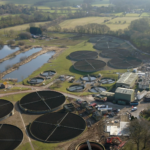
Every year, companies carry out expensive and time consuming inventories within their warehouses and outside storage areas.
![]()
These inventories require a huge mobilisation of material and human resources, which often involves
stopping onsite activity. This can have a detrimental impact on a company’s business.
ProDroneWorx drone inventory management process has been designed to automate inventories with very little
human intervention. As a result of this efficient workflow process, drone technology can save clients a lot of
money while also producing the digital inventory data very quickly and in various formats that haven’t
been available until now.
Case Study : Project 7
![]()
Project 7 Construction was seeking an alternative way of geo-locating the company’s inventory across
two large, five acre sites related to a specific project. They wanted staff members to be able to quickly
and easily locate any material across both sites on an iPad or PC, so that it could be collected and then
sent to alternative locations.
Historically, staff members had to either walk or drive around both sites to locate the materials requested. This was very time consuming, as literally hundreds of pieces of material were stored on both sites.
Indeed, inventory management across two large outdoor sites represents a huge challenge for the best run companies. The company therefore turned to one of the newest methods now available for inventory management and that involved using drone technology, plus specialised photogrammetry and GIS software.
![]()
ProDroneWorx discussed a range of services with the client and agreed that a high resolution orthomosaic, boundary measurements, and grid based mapping and tagging of the inventory would be provided at both sites.
To achieve a single high-resolution map of each site, hundreds of individual images were processed into a true to scale orthomosaic, giving Project 7 the ability to identify any piece of material in one viewing window. The scaled orthomosaic also meant that accurate relative measurements could be taken of the boundary or any material onsite. A high-resolution PDF with a grid and tagging system was created for each site, which allowed for the easy identification of material and more effective communication across the team.
The client was delighted with the results. Project 7 said: “The use of drone technology and the digital information it produces has transformed our inventory management by saving us both time and money. What used to take weeks can now take just a few days while the digital information has benefited us enormously through better collaboration and communication.”
If you would like to read more articles like this then please click here.


More Software & Technology Features
- £115M lost to cyberattacks
28 Nov 25
Small construction firms lose over £115 million to cyberattacks annually, making it the UK’s third-most financially impacted sector, according to a new study.
- Small Builders, big wins: Practical Artificial Intelligence that speeds up UK Construction Operations
12 Sep 25
Practical advice where artificial intelligence can return time and protect margin for smaller UK contractors.
- Alternative building practices are crucial to unlocking AI infrastructure benefits
7 Mar 25
With AI capabilities developing at an unprecedented pace, the government has announced its AI Opportunities Action Plan.